Vertical cliffs dropping 600 meters right into the sea. Mountain peaks 1500 meters above the sea. Flowing roads along the coastline and in the valleys. Unspoiled nature. The Norwegian Fjords are unique in the world and an experience everyone should seek.
Fjord Norway is the part of Norways west coast with the most famous fjords. It stretches from Stavanger in the south to Kristiansund in the north and consists of four counties: Møre & Romsdal, Sogn & Fjordane, Hordaland and Rogaland. The most popular way of experiencing the fjords is to go on a cruise; but unless you got your own superyacht you’ll miss out on many of the best parts and you’ll have to share your experience with thousands of other visitors when it’s your connection with the nature you’re really after. Better then to go on a road trip and break free from the beaten path.
The actual area with the most spectacular fjords is not that big and can be covered in a week with a couple of hikes thrown in. As usual, a bit of planning makes sure that eating and sleeping is an experience in itself. This is our suggestion for the perfect road trip in Fjord Norway for the first time visitor.
Day 1: Oslo – Stavanger by Gaustatoppen: Feel the history
Oslo – Drammen – Kongsberg – Onto road Fv 651 by Saudal – Tuddal – onto road 37 before Rjukan – Krossen – onto road 9 by Haukeligrend – onto Fv337by Nomeland – Sinnes – onto road 45 – Byrkjedal – Oltedal – onto E39 by Ålgård – Stavanger
Fjord Norway starts in Stavanger, but the trip starts in Oslo. This gives you the opportunity to experience how the landscape changes from the low lands around the capital to the higher mountain areas in the middle of the country. If you’ve ever wondered how far from Oslo you have to go to start seeing some truly beautiful nature, 2.5 hours is the answer.
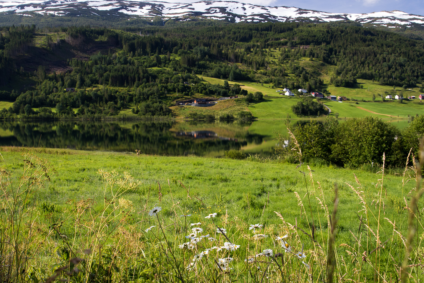
The town of Notodden is one of the first stops that’s really something else; sheltered in a big valley in a way that reminds us of Lone Pine, California. It’s also part of the Rjukan-Notodden Industrial Heritage site that’s been on the UNESCO World Heritage list since 2015.
But it’s when you start the climb up towards Gaustatoppen that you really start to see the change in scenery. The landscape transforms to more alpine plants and the mountain peaks start filling up the horizon. Gaustatoppen itself is the highest peak in southern Norway; a clear day views over 1/6 of the country from the 1883 meter peak is provided. Hiking to the peak is perfect for a daytrip from Oslo, but can be quite a squeeze to take on the road to Stavanger. If you plan on taking a stop at the main paths to Gaustatoppen, be there early as the parking areas fill up quickly.
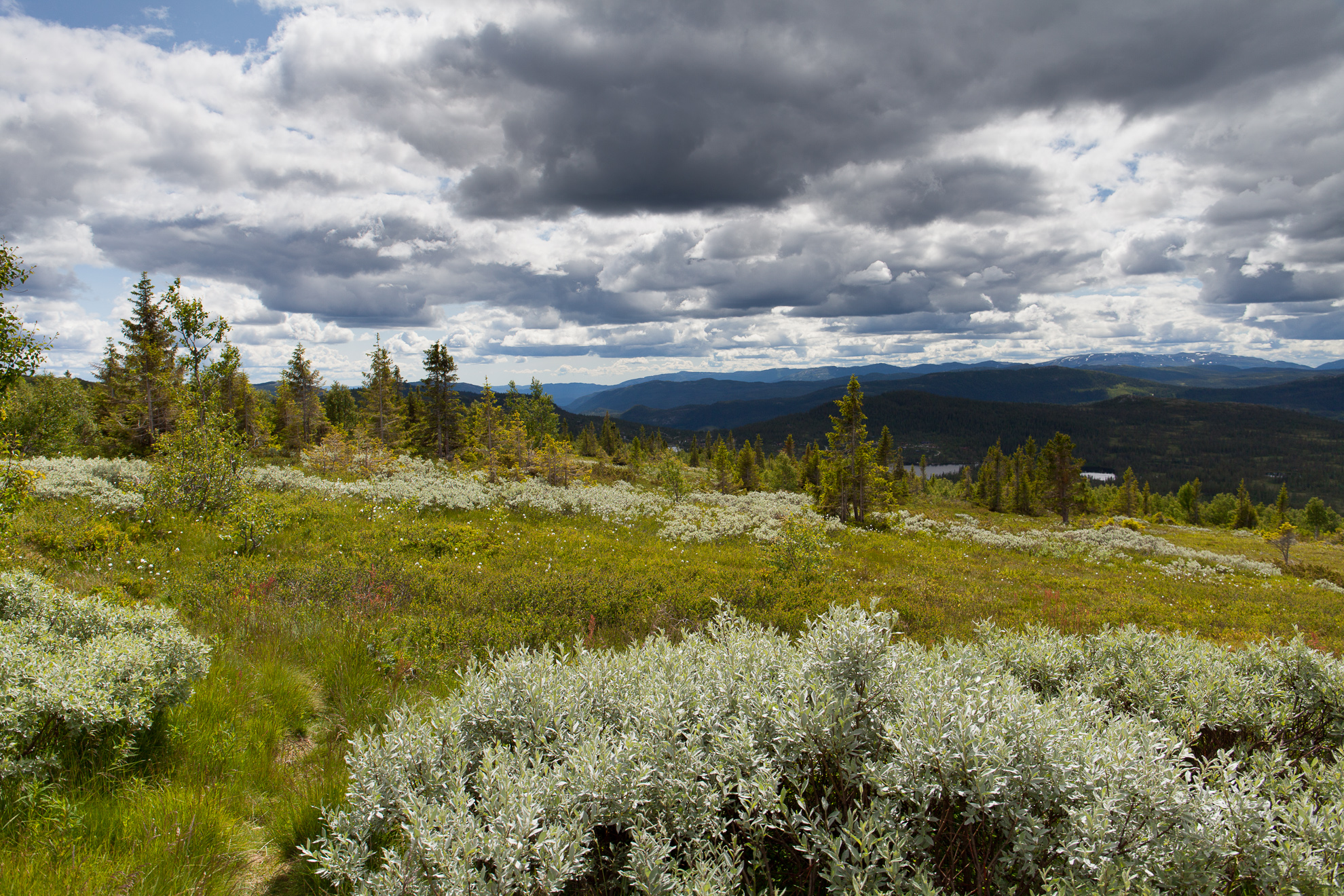
The alpine terrain in Telemark, close to Gaustatoppen.
Rjukan can be found after a quite steep descent and is the other part of the Rjukan-Notodden site, a village situated so deep in a valley that it’s hard to imagine the sun ever reaching the houses. A number of old hydro-electric plants used to create fertilizers from the nitrogen in the air are the reason for the historic importance. It was built to meet the demands of the modernizing agriculture in the entire western world in the early 20th century.

Ferry crossing outside Stavanger.
Day 2: Hike to Preikestolen: Afraid of heights?
Stavanger – Sandnes (E39) – onto road 13 – Lauvvik – (ferry) – Oanes – continue on road 13 Towards Tau – Fv529 (Preikestolsvegen) – Preikestolen Fjellstue – same way back
We hope not, as one of the most spectacular experiences in the world includes standing on a 25×25 meter rock 600 meters above the waters of Lysefjorden. Preikestolen, the Pulpit Rock, is one of the most famous attractions in Norway and is quite accessible compared to many other nature attractions in Norway. You can go using guided tours and boats from Stavanger but it’s just as easy, if not easier, to go by car to Preikestolen Fjellstue. There’s a big parking which you pay for on the way out and a cabin where you can eat and stay. However, get there early. It’s a very popular attraction and the large masses start to get there by 9.30-11 am. The parking area closest to the cabin spots will fill up and the trail will get crowded. You can also start to hike in the middle of the night, around 2-3 am, to reach the Pulpit Rock as the sun rises above the horizon.
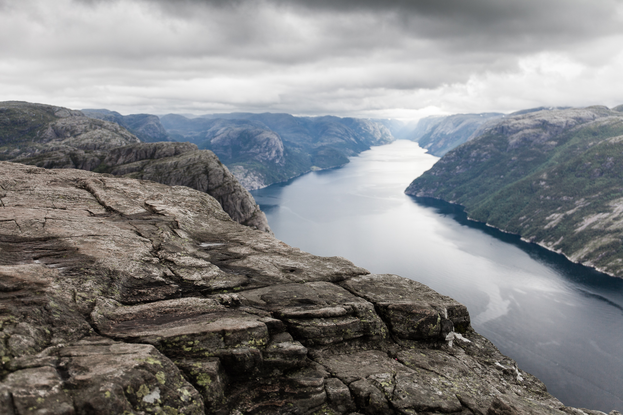
Preikestolen, the pulpit rock.
The hike itself takes around 3.5-4 hours depending on how long you want to stay at the top. It’s around 4 km in length with 600 meters total ascension meaning it’s mostly walking up and down. The trail is well maintained and has good markings; you don’t need a guide or a map. So while accessible and not that long you’ll still get a proper workout. Bring water, something to eat, camera and rain clothes.
Stavanger itself is “oil country” and marked by the needs for modern, industrial buildings. But the wooden, white houses in the old parts of the city are quite charming and provides a clear break. Down by the harbor Renaa is three restaurants in one house; a café (Renaa Xpress), a bistro (Renaa Matbaren) and a gourmet restaurant (RE-NAA). The bistro is just how we like it, international in style and execution but with a strong local emphasis on ingredients. A great way to replenish the body with energy after the trip to the Pulpit Rock.
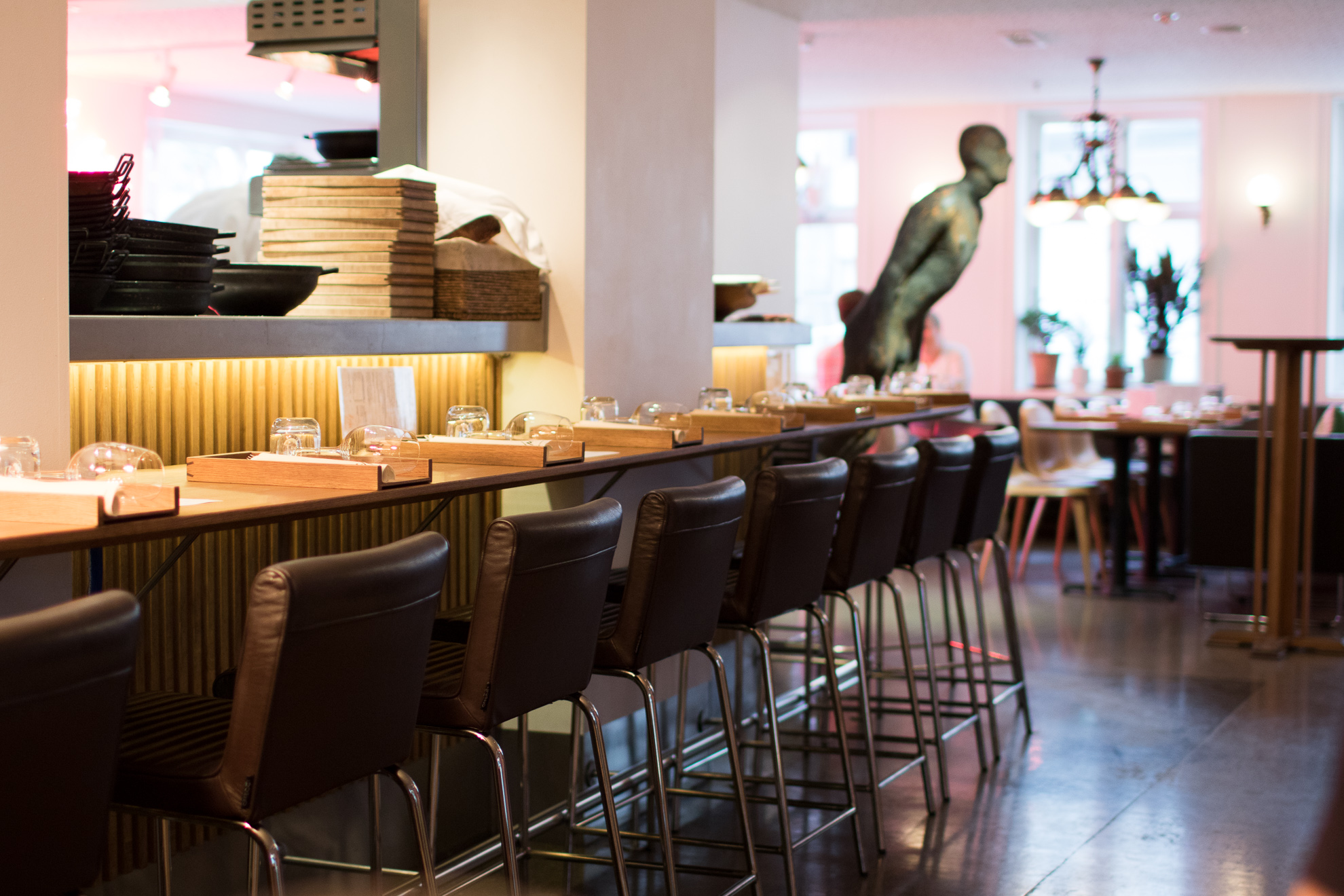
Renaa: Matbaren, Stavanger.
Day 3: Stavanger – Bergen: Live like a king – literally
Stavanger – E39 to Aksdal – onto E134 – Ølen – Onto 13 by Skare – onto 551 by Odda – Ferry from Jondal – onto 49 – Norheimsund – Eikedalen – Tysse – Indre Arna – Bergen
While driving to Preikestolen you got a taste of driving in the area, setting out to Bergen is the first day of the full Fjord Driving Experience. You can go on E39 the whole time, but changing to E134 by Aksdal means that you get to experience the coastline as well as more inner fjords and passes. Between Kyrping and Skare on the E134 you’ll encounter Langfossen, an imposing waterfall with a nice rest stop.
It doesn’t really matter which road you take, it’s a beautiful drive either way. Only problem is that you’ll spend more in tolls and ferry fees than on gas.
When Norway was under Danish rule by King Christian Quart during the 17th he century ordered that for every half- to one day travel by sea there needed to be a guest house suitable for him. Bekkjarvik Gjestgiveri just south of Bergen was founded during this time and is still in operation today. Staying at the Inn not only allows you to rest in the historic surroundings but also eat the food created by the 2015 Bocuse d’Or Champion and his almost as accomplished brother.
Day 4: Over vidden – Time for a walk
Bergen is surrounded by seven mountain peaks. A hardcore hiker takes them all in a day (7-fjellsturen) netting in 35 kilometers and 2400 meters total ascension. A slightly more laid back hiker can either take four of them, 4-fjellsturen, or the hike called “Over vidden” which goes between the two main peaks, Fløyen and Ulriken, connected to the town via public transportation. It’s still quite a hike stretching some 13 km and with a few hundred meters ascension.
Norwegian guide books state that this is a four hour hike but you should budget around six hours or so. If you start the day late, grab a coffee at Det lille kaffekompaniet (open 10:00-22:00 or so) close to the lower stop of Fløibanen, one of the better coffee bars this side of the country serving coffee from several of the Norwegian specialty roasters such as Supreme Roastworks, Tim Wedelboe and Solberg & Hansen. Fløibanen wil take you up on Fløyen where you first gain altitude towards the peak of Fløyen before following the signs towards Ulriken.

Over vidden, Fløyen – Ulriken.
This being Bergen you will be slowed by rain showers and photographing the scenery. There will be puddles and mud you’ll have to get through, so use shoes that protect your feet and that you don’t mind getting wet. Also, park your car in the city or where you’re staying, there’s very little parking available near the cable cars and they don’t take you to the same place either. Fløibanen starts close to Bryggen while the lower station to Ulriksbanen is situated close to the hospital and the Montana Hostel.
Bergen is one of the biggest cities in Norway and has a lot of alternatives for staying and eating. Scandic Ørnen provides contemporary accommodation at relatively affordable prices just a little bit away from Bryggen. Roast (at the top of Scandic Ørnen) provides a focused, contemporary grill menu and is not just a hotel restaurant. The mixed grill plate have wonderful, juicy and flavorful sliders (295 NOK) but he wine list is almost a joke with very few wines of the limited list actually available. Grab a beer instead. For the ultimate gourmet dinner in Bergen, try Bare Restaurant – a gastronomic New Nordic establishment with a very strong focus on local ingredients.

Mount Ulriken, Bergen.
Day 5: Berge – Øye: Remember to blink
Bergen – Indre Arna – E16 to Lærdal – onto 5 – Søgndalsfjøra – Skei – off E39 at Byrkjelo – Utvik – Innvik – Olden – Loen – Stryn – onto 15 – (short passing at E39 again) – Onto 60 after Grodås – onto 655 before Hellesylt – Øye
Maybe a little sore from the hike yesterday, or rested and alert, it’s time to take to the road again. Todays goal is Hotel Union Øye, a favorite among international dignitaries since its opening in 1891. But the road there is almost as spectacular as the target.
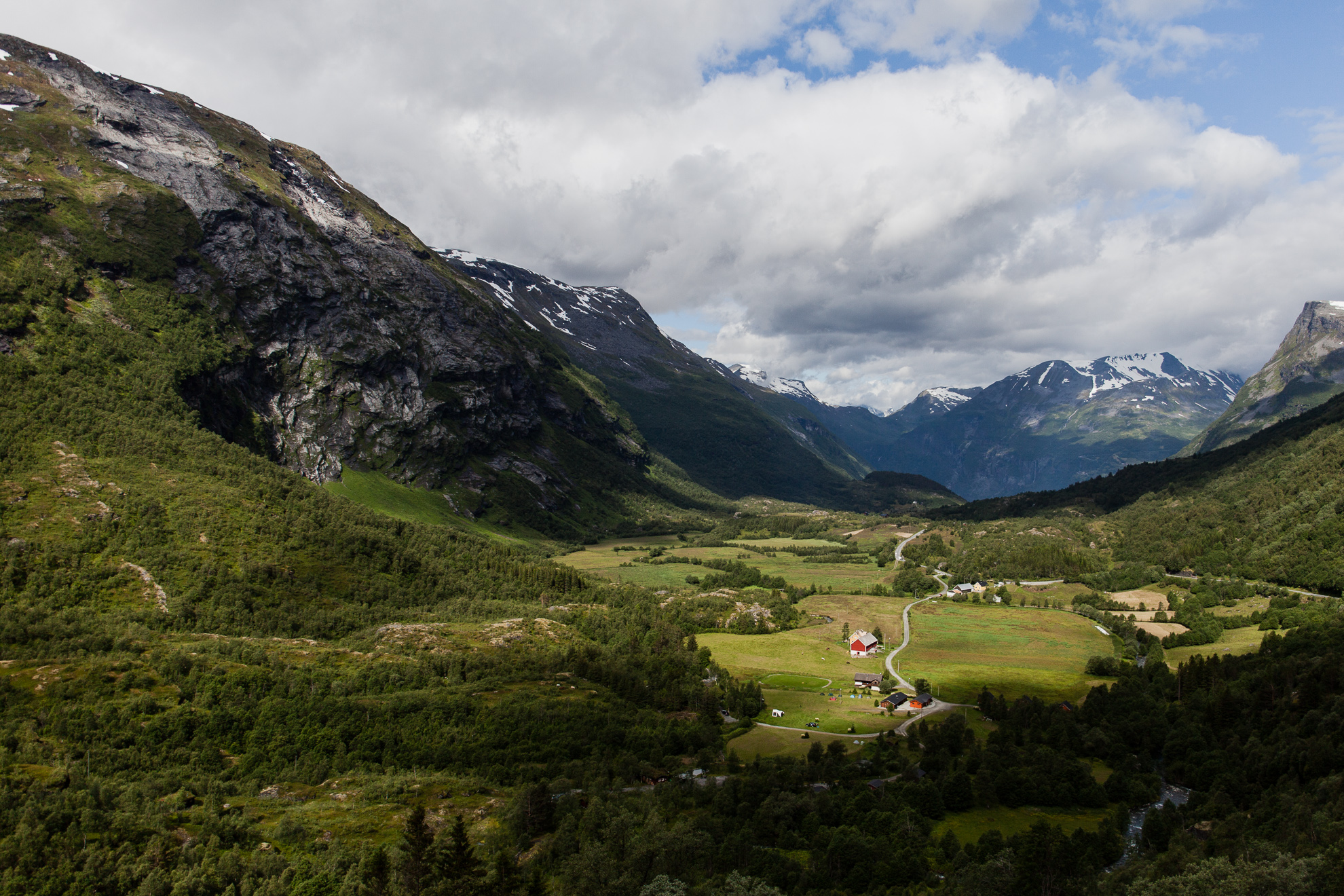
You’ll pass the beautiful village of Dale, home to the wool knitwear producer Dale of Norway since 1879. Peder Jebsen started the factory here due to the ample supply of hydro energy and the strong local knitting traditions. Driving through the village you can understand why, the high peaks and dramatic waterfalls are not only the ingredients for a factory location but also as spectacular surroundings as you can find.
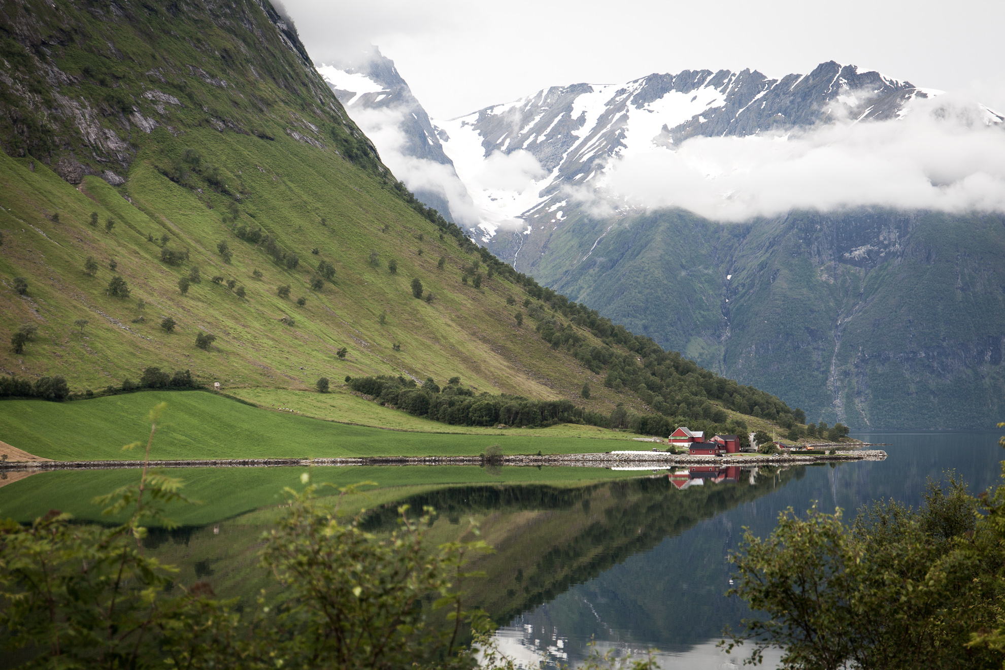
The Norwegian countryside, close to Urke in Sunnmørsalpene.
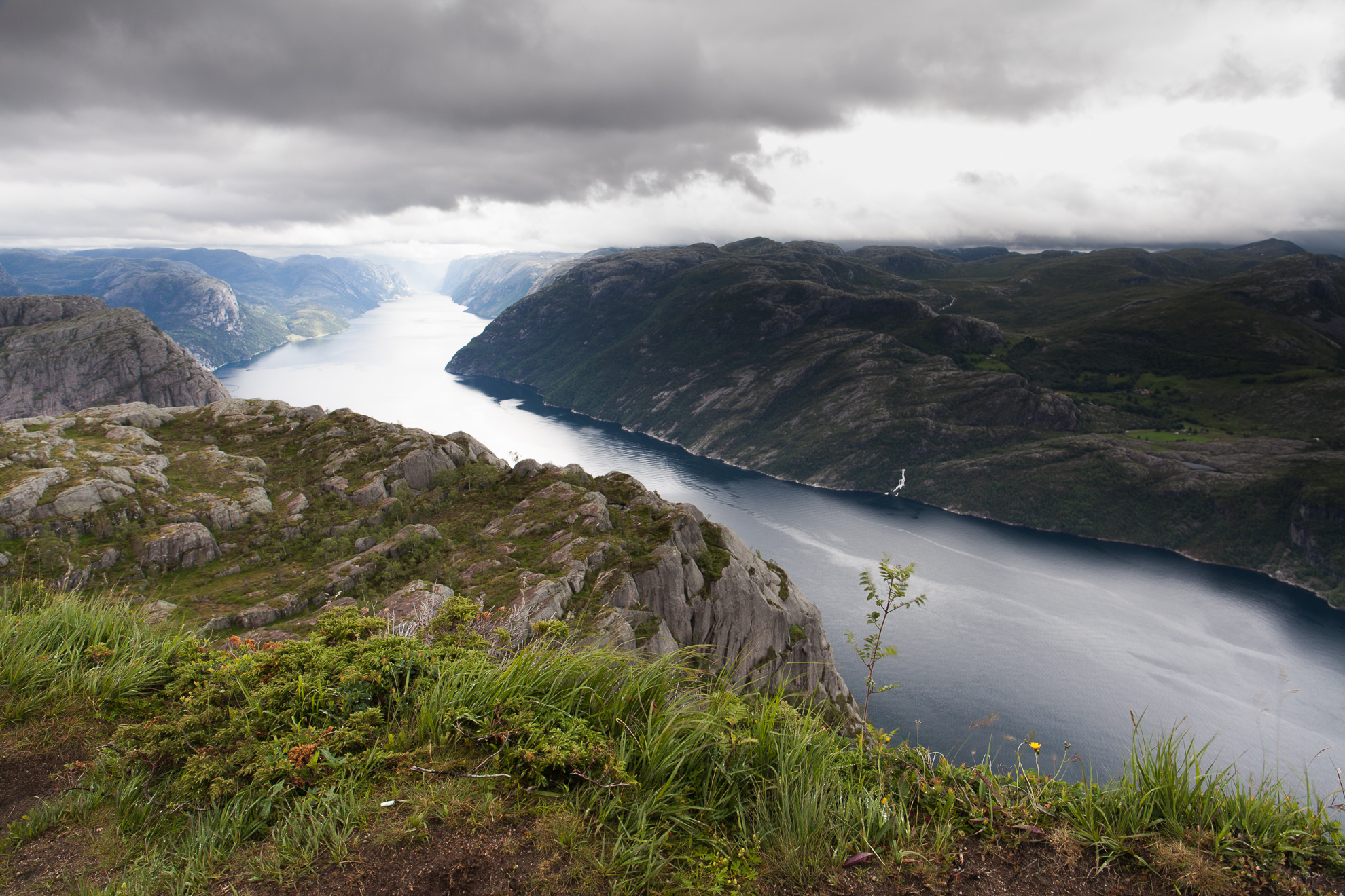
Next up is the Nærøyfjord which together with the Geirangerfjord form The West Norwegian Fjords, a UNESCO world heritage site due to the fjords exceptional beauty with narrow straits and high mountains steeping right down to the water.
They were voted as the world’s best preserved attractions on the UNESCO list by National Geographic in 2009. While they are virtually unspoiled, you won’t be visiting them yourself in the summertime. But don’t despair, there’s lots of other easy accessible areas where you’ll hardly see another person and can be alone with some of the most spectacular nature on earth.
This leg of the trip is not without tunnels but almost without tolls – and just jam packed with great drivers road. The road leading to Gudvangen (and the Nærøyfjord) from Voss is one of those. E39 out of Skei towards the pass at Byrkjelo over to Utvik and along Innvikfjorden is another, the view in towards the valley of Stardalselva is one of those that you could just lose yourself in. The stretch of Innvik to Olden is called the “most beautiful road in Norway” and it’s almost true. For another stop along the way, Loen is a very good alternative with lots of outdoor activities in the area.
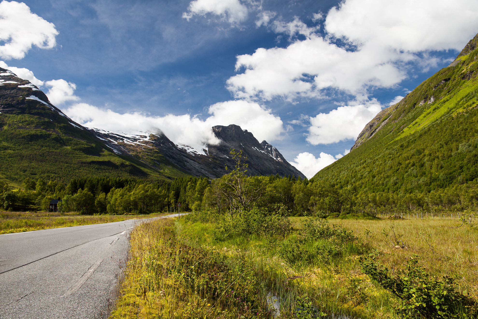
Norangsdalen.
But that’s a digression, because the most beautiful road in Norway, and one of the worlds greatest drivers roads that actually leads somewhere, is Norangsdalen to Øye, from the point where road 655 diverts from 60 (almost at Hellesylt) and goes to the small village of Øye.
At Øye, Hotel Union awaits you. This is more than just a hotel with historic significance. This is living and breathing history that you can take part in and experience – or just enjoy. It’s situated in the shadow of Slogen, a 1564 meter peak which can be ascended in day, in the bay of Norangsfjorden. 3-course dinner is recommended (615 NOK per person, 475 NOK for a wine package). The breakfast is a feast of Norwegian specialties and many local artisan products. Remember to book your stay in time.
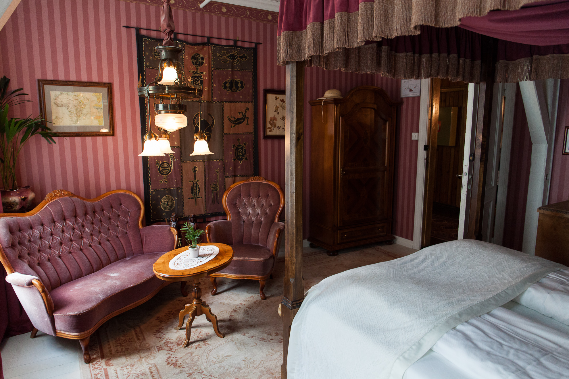
Room Karen Blixen at Hotel Union Øye.
Day 6: Øye – Trollstigen Camping: One road leads to the next
Øye – Ålesund – Molde – Eide – Atlanterhavsveien – Kristiansund – Bergsøya – Nes – Åfarnes – Åndalsnes – Trollstigen Camping
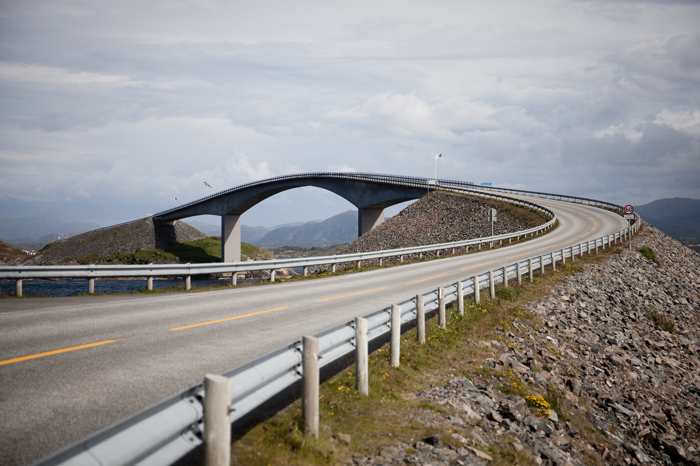
The main goal for this day of the trip is to drive Atlanterhavsveien, an 8.3 km stretch of the 36 km National Tourist Road Atlanterhavsvegen (road 64) between Bud and Kårvåg. Eight bridges connect a number of small islands and skerries, many with built paths and other structures designed to connect the visitor to the surrounding archipelago landscape.
Before you reach Atlanterhavsveien, you pass Ålesund in this leg of the trip. The town was basically leveled by a fire in 1904 and after that rebuilt in a stone-based Art Noveau style. As a result the city center is coherent in its style as well as incredibly beautiful. Take a quick walk and grab a coffee at Invit Espresso Bar (unfortunately closed during the summer) before pressing on.
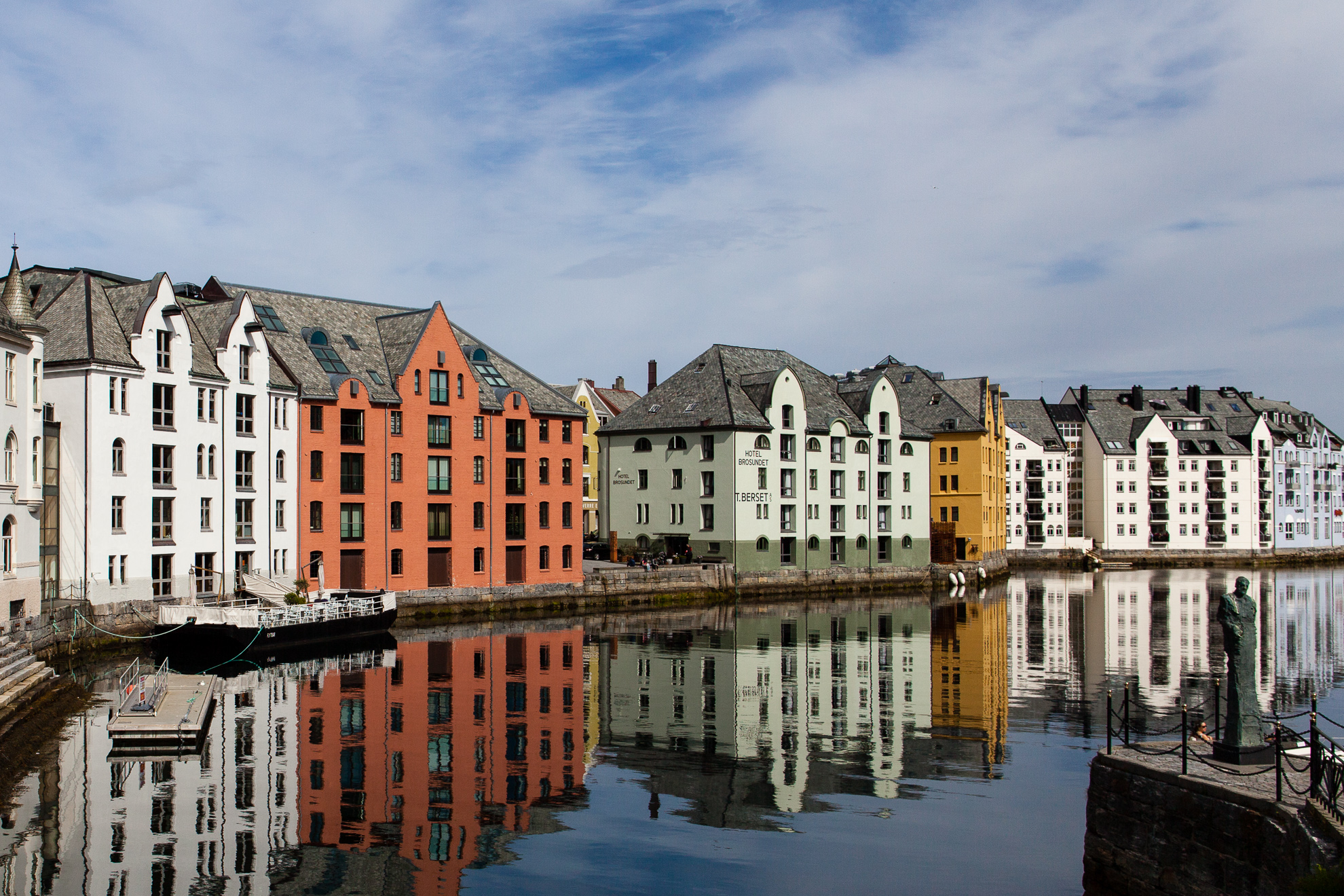
Ålesund brygge.
Atlanterhavsveien was only finished in 1989 but is reaching cult status and continues to be one of the most popular and iconic natural tourist attractions in Norway. It’s not the greatest drivers road simply because you’ll want to stop everywhere and you have to avoid other cars stopping everywhere. So stop yourself, take a waffel at the café on Eldhusøya or just eat a little food pack.
Atlanterhavsvegen continues to Kristiansund, but nothing quite compares to that stretch, so stop for a little food or some other provisions but keep pressing for Trollstigen instead of stopping for the night here. Trollstigen Camping provides cabins as well as areas for tents and is open late. To secure a cabin you might have to book in advance, but there’s always room for a tent.
Storseibrua on Atlanterhavsveien.
Day 7: Trollstigen – Gjendesheim
Trollstigen – Valldal – Eidsdal – Geiranger – onto 63 – onto 15 east by Langvatnet – onto 51 by Randen – Gjendesheim
By sleeping at Trollstigen Camping you set yourself up for being able to drive Trollstigen without other traffic. Even in the middle of summer there’s not much traffic at all before 9 a.m. Trollstigen has been made immortal in numerous best driver’s road lists, with the eleven hair pin bends and the bridge over Stigfossen as the most defining features. The road is quite narrow making it necessary to drive it without other traffic to truly enjoy it. At the top of Trollstigen is a café (which only opens later in the day) and pathways to several viewing platforms with spectacular views over the valley. Trollstigen is only open from mid May to when to snow starts to fall, usually in October.
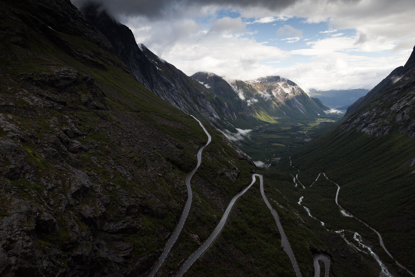
View over Trollstigen and the Ister Valley.
Continue and you’ll soon be at Gudbrandsjuvet, a 25 meters deep gorge with its own set of viewing platforms that are art in themselves. Another café in the same style of modernist concrete architecture as the one at Trollstigen is also available.
The entire road from Trollstigen to Geiranger is one of the national tourist roads, and it’s absolutely breathtaking in its entirety. The view down into Geirangerfjorden from Ørnesvingen, the other UNESCO World Heritage protected fjord, is simply breathtaking. Unfortunately, from Ørnesvingen and forward south past Geiranger you won’t be alone.
Mountain road south of Geiranger.
During tourist season there are literally hundreds of coaches in this area, especially from Geiranger up to Dalsnibba. The road is exceptionally beautiful and would make for fantastic, spirited driving if it wasn’t for all the traffic. After an initial steep ascent the rest of the trip is in highland terrain with the goal, Gjendesheim, at 1001 meters above sea level.
There are many more beautiful views and exciting places to visit in the mountain terrain. Reinheimen National Park and Beitostølen are just two examples, the many valleys and lakes are other. A nice stop is Tora Utleggsbru where you can eat a traditional waffle before soldiering on.
Day 8: Besseggen (Gjendesheim – Oslo)
Gjendesheim – Beitostølen – Fagernes – Bagn – Hønefoss – Oslo
Perhaps the most well-known hike in Norway is Over Besseggen in Jotunheimen National Park. Besseggen is a ridge up towards a peak and the highlight of the hike. The hike is fairly accessible and easy while providing quite a feeling of accomplishment once it’s done. The views over Jotunheimen and the two lakes Gjende (984 meters) and Bessvatn (1374 meters) is magnificent and you must remember to take them in while walking up the ridge, even though it can feel a bit airy. Remember to pack warm clothes, food, water, hat and gloves. Even in late summer the temperature is hardly above zero degrees Celsius and the weather changes quickly.
The standard route is to go by boat from Gjendesheim to Memurubu and then walk back to Gjendesheim over Besseggen and Veslefjell. The hike is around 16 km with the height delta of 759 meters from the lowest to the highest point. It can be finished the reverse way as well, but the logistics is much simpler going from Memurubu to Gjendesheim. Normally it takes around 5-8 hours depending on the number and length of pauses. The real enthusiasts run this route in 1.5-2 hours.

The Bess Ridge (Besseggen) center top-right.
Accommodation is available at DNT’s tourist cabin at Gjendesheim. Anyone who shows up will get a place to sleep, in a dormitory or tent, with rooms only available for booking when staying for more than two nights. Breakfast and dinner is also served. Due to the popularity of the hike the boats to Gjendesheim (Gjendebåtene) you need to get up early to get on the first boat in the day. Be at the bridge before or around 7 a.m. to be able to go with the first boat of the day. On days with very many eager hikers they continue ferrying people until everyone has gotten to Memurubu.
If you manage to get on one of the early boats you can very well walk Besseggen and drive back to Oslo the same day. Just feel how exhausted you are and take an extra night, or stop on the way, if you start feeling tired. Soon the landscape starts flattening out and and all you have left is memories, and hopefully photos, of the fjords and alpine landscapes of western Norway.
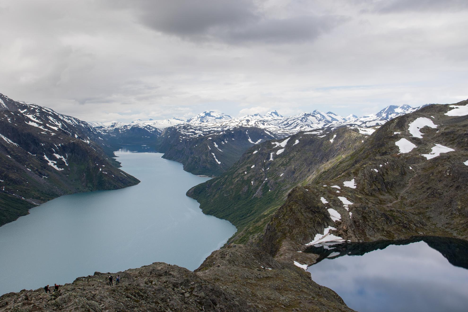
View over Lake Gjende and Bessvatn from Besseggen.
This trip suggestion is only a starting point to be able to experience some of the most famous and iconic Norwegian places in a single road trip. There’s so many more places to visit (Landscape Hotel Juvet), hikes to complete (Romsdalseggen) and views to take in (Trolltunga) that it wouldn’t be possible in a single trip. The brain would simply go into a state of over stimulation. But it also makes us happy, to know that we’re not finished with Norway just yet.