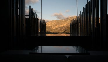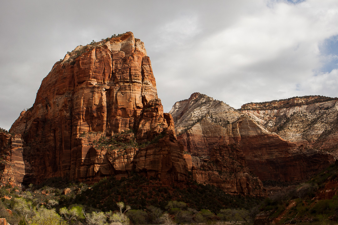
Zion National Park is almost a secret hidden in plain sight, at least when compared to the popularity of Grand Canyon for visitors to Las Vegas and the surrounding area. Zion Canyon opens up like a garden of Eden and is both awe inspiring and brings tranquility at the same time. Zion offers a wide variety of hikes, from short and easy ones to exhausting full-day hikes. Angels Landing via the West Rim Trail, 8 km/5 miles and around 4 hours round trip, is one of the most iconic and also rewarding hikes in the world, with expansive views over the canyon after a 453 meter/1488 feet climb along switchbacks and the final ridge up to the natural plareau at the summit of the Angels Landing rock formation which towers in solitude over the canyon floor.
With a steady increase in visitors every year, 3.65 million in 2015, it’s not like you’re going to be for yourself in Zion, at least not on the popular trails, but the flow of visitors is well managed through the free shuttle bus system. The road in the main valley is only open for the public during the winter so the rest of the year you have to park by the Visitor Center or in Springdale and hop on the shuttle bus. The start of the Angels Landing hike is at the Grotto, fifth stop for the shuttle, and during this time there’s a narrator giving some history and information about the park. Already on this brief bus tour the views are mesmerizing.
No special gear is needed for this hike and the navigation instructions can be summarized into: “From the Grotto Picnic Area, cross the Virgin River and take right onto the West Rim Trail. Follow until the Scout Lookout point where the Angels Landing Trail starts and the West Rim Trail breaks off to the left. Continue up to the summit and then take the same way back down to the Grotto Picnic Area.”. Most of the trail until Scout Lookout is nicely paved and quite stroller friendly, except for a section along the Virgin River that’s a bit sandy. Bring water, something to eat or treat yourself with at the summit and some clothes to put on if the weather changes for the worse.
Where the first set of switchbacks connects to Refrigerator Canyon.
The trail starts on the opposite side of the road from the bus stop. At first it’s sandy and only very gently ascending as it follows the Virgin River, feeling just like a nice stroll in the park until the first set of switchbacks starts leading upwards. During this section the extent of the climb slowly becomes obvious, Angels Landing really towers above the canyon and only looks more imposing the closer you get.
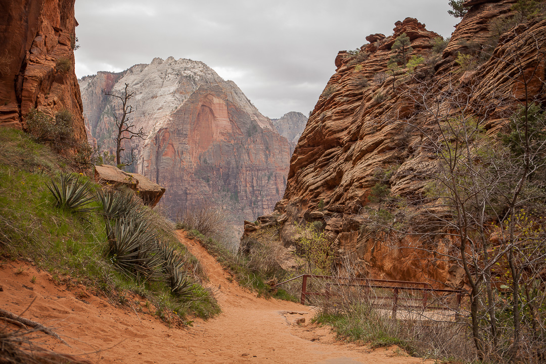
Remember to turn around and admire the views while stopping for rest or to drink during this first ascent. The path follows the outside the of the rock through Refrigerator Canyon where the nature changes into a very cozy forest trail that is notably colder than the rest of the area. Another set of switchbacks follows, these 21 turns are called Walter’s Wiggles and are both tighter and steeper than the first ones. At the top of these the Scout Lookout area is located, which is a nice rest stop and also the point at which you see the final ridge up Angels Landing and start to realize that the warnings about not doing this hike in the wet, when there’s ice or thunderstorms or not to bring any younger children is probably good advice.
The ridge up Angels Landing seen from Scout Lookout
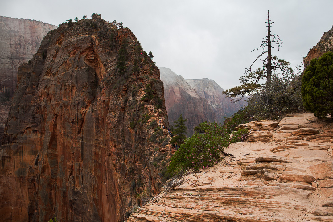
From this point on the trail is steep, really narrow in places, has long drop-offs or all at the same time. There are chains bolted into the rock to grab for some extra security during the most exposed sections. Right at the start there’s a point where it’s not possible to meet the ones who are on the way down so you have to form groups and pass in turn. This continues for most of the way up but usually works out quite fine even when there are many hikers on the trail. You get a chance to catch your breath and take in the views while waiting and there’s really no point in rushing.
If you’re nervous due to the heights it can be a very good tactic to join one of these spontaneous groups, especially if there are people that seem comfortable, and just follow in their footsteps. This gets your mind in the right mode and keeps it occupied with doing something productive instead of worrying – this can be crucial if you’re afraid of heights.
This part of the trail is actually longer than you might think and not just a final push to the top. It’s not technically difficult, but can be quite exhausting if you get a chance to climb in your own pace.
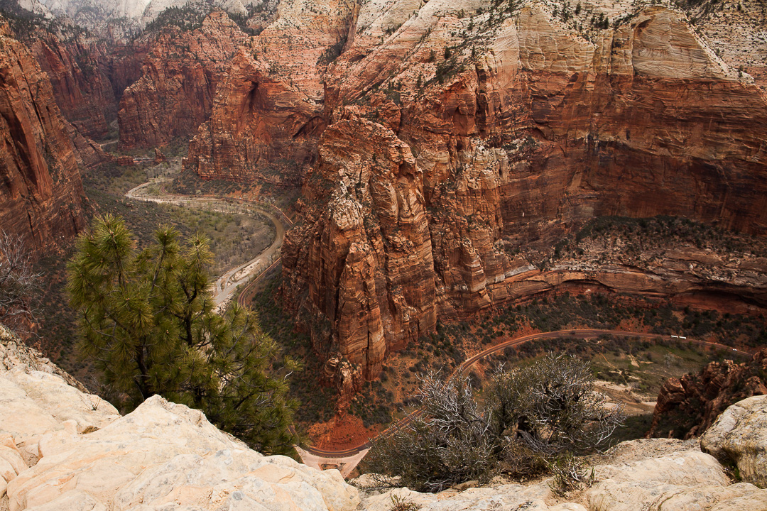
View over Zion Canyon from Angels Landing.
Once at the summit there is actually quite a lot of space to rest, eat your energy bars and just have a nice time before descending. The descent is not really that spectacular in itself since it is the same way down, but it does give you the chance to see the nature and views from slightly different angles and noticing new details.
With a good pace but quite frequent photo or resting stops the round trip takes 4 hours with other people on the trail. During low season it can probably be completed faster, but the limiting factor is mainly waiting for passing during the ascent and descent from Scout Lookout to the summit.
What makes Angels Landing spectacular as a hike is that the trail is varied but always possible to make challenging for yourself – and with constant breathtaking views. At the summit there’s a proper reward and perhaps most importantly, there are no bad sections that you’d rather skip along the way.
Directions & tips
See above for the directions of the hike, no maps or navigation equipment is needed. There has been at least six recorded deaths on this hike since 2004, but safety has been much improved since the chains was set up. Use proper, non-slippery shoes and make sure you have good footing in the precarious sections, only using the chains for safety and not relying on them for balance since other people might yank them.
Zion National Park is only a 2.5 hour drive from Las Vegas, but there is a different time zone in Utah from Nevada so one hour is lost when crossing the border. Parking by the Visitor Center usually fill up by mid morning (around 10:00 AM) so a really early start from Las Vegas is recommended if this is the starting point for the day.
More parking can be found in Springdale from where there’s another shuttle line that goes to the Visitors Center. There are some basic facilities at the Visitors Center, with a grill restaurant as well as a café at the Zion Lodge (the shuttle bus stop before the Grotto Picnic Area). More cafés, restaurants and lodging can be found in Springdale.
To get to Bryce Canyon from Zion National Park, the scenic drive along the Mt. Carmel Highway (SR-9) actually goes through the park but continues past the junction to the Zion Canyon road. From Springdale it’s only a 2 hour drive that passes the Checkerboard Mesa and the Red Rock Canyon in the Dixie National Forest, among many other beautiful places.
| Length: | About 8 km/5 miles roundtrip |
| Time: | 3-4 hours |
| Total Ascension: | 453 m/1488 feet |
| Roundtrip: | Yes, but the hike goes up and down the same way. |
| Start: | The Grotto stop on the Zion Canyon Shuttle line (GPS: 37.2585788,-112.9514174) |
| Parking: | The Zion Canyon Visitor Center (37.2000943,-112.9870515) or in Sprindale with a shuttle bus to the visitor center (more info on parking) |
| Difficulty: | Medium – there are airy and vertigo inducing sections with a little bit of scrambling |
| Exhaustion Factor: | Medium |
| Season: | Possible all year, but best during spring and fall. Hike should not be attempted when there is snow or ice on the mountains. |
| Cost: | Yes, Zion National Park belongs to the US National Park Service system and an entrance fee is mandatory. Fees in 2016: $30 for a car, $25 for a motorcycle or $15 per person. The annual pass at $80 for all National Parks and Federal Recreation Lands is recommended if you’re an American citizen or planning to visit several parks during your stay. |
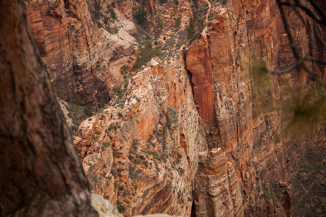
One of the narrow passages to Angels Landing seen from further up the trail.